
Mormal topographic map
Interactive map
Click on the map to display elevation.
About this map
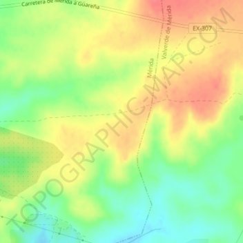
Name: Mormal topographic map, elevation, terrain.
Location: Mormal, Mérida, Badajoz, Estrémadure, Espagne (38.89870 -6.28813 38.91870 -6.26813)
Average elevation: 281 m
Minimum elevation: 249 m
Maximum elevation: 309 m