
Thank you for supporting this site ❤️
Make a donation
Make a donation
Loilem Township topographic map
Click on the map to display elevation.
Thank you for supporting this site ❤️
Make a donation
Make a donation
About this map
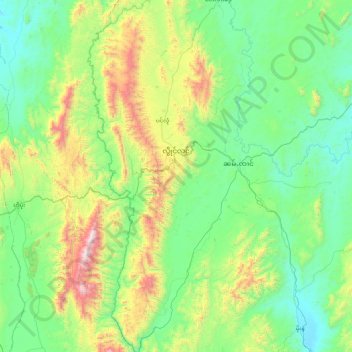
Name: Loilem Township topographic map, elevation, terrain.
Location: Loilem Township, Loilen District, Shan State, Myanmar (20.45395 97.34325 21.27371 97.64290)
Average elevation: 1,172 m
Minimum elevation: 801 m
Maximum elevation: 2,479 m
Thank you for supporting this site ❤️
Make a donation
Make a donation
Other topographic maps
Click on a map to view its topography, its elevation and its terrain.