
Thank you for supporting this site ❤️
Make a donation
Make a donation
Nirmal topographic map
Click on the map to display elevation.
Thank you for supporting this site ❤️
Make a donation
Make a donation
Nirmal
Nirmal is located at 19°06′N 78°21′E / 19.10°N 78.35°E / 19.10; 78.35. It has an average elevation of 340 metres (1100 feet) on the foot hills of Nirmal range, which is located in the Deccan plateau.Nirmal has chain tanks built around it.
Thank you for supporting this site ❤️
Make a donation
Make a donation
About this map
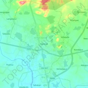
Name: Nirmal topographic map, elevation, terrain.
Location: Nirmal, Nirmal mandal, Nirmal, Telangana, 504106, India (19.05246 78.30860 19.13246 78.38860)
Average elevation: 335 m
Minimum elevation: 310 m
Maximum elevation: 424 m
Thank you for supporting this site ❤️
Make a donation
Make a donation