
Chapèze topographic map
Interactive map
Click on the map to display elevation.
About this map
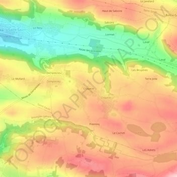
Name: Chapèze topographic map, elevation, terrain.
Average elevation: 344 m
Minimum elevation: 224 m
Maximum elevation: 437 m
Other topographic maps
Click on a map to view its topography, its elevation and its terrain.
Moulin Vieux
France > Auvergne-Rhône-Alpes > Isère > Saint-Savin
Moulin Vieux, Saint-Savin, La Tour-du-Pin, Isère, Auvergne-Rhône-Alpes, France métropolitaine, 38300, France
Average elevation: 377 m
Demptézieu
France > Auvergne-Rhône-Alpes > Isère > Saint-Savin > Demptézieu
Demptézieu, Saint-Savin, La Tour-du-Pin, Isère, Auvergne-Rhône-Alpes, France métropolitaine, 38300, France
Average elevation: 332 m