
Vaasa topographic map
Interactive map
Click on the map to display elevation.
About this map
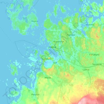
Name: Vaasa topographic map, elevation, terrain.
Average elevation: 11 m
Minimum elevation: -4 m
Maximum elevation: 99 m
Other topographic maps
Click on a map to view its topography, its elevation and its terrain.
London
Finland > Ostrobothnia > Jakobstad
London, Jakobstad, Jakobstad sub-region, Ostrobothnia, Western and Central Finland, Mainland Finland, 68600, Finland
Average elevation: 6 m