
Gemeinde Berndorf topographic map
Interactive map
Click on the map to display elevation.
About this map
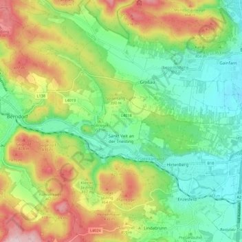
Name: Gemeinde Berndorf topographic map, elevation, terrain.
Location: Gemeinde Berndorf, Bezirk Baden, Niederösterreich, Österreich (47.92094 16.07129 47.96721 16.17943)
Average elevation: 361 m
Minimum elevation: 257 m
Maximum elevation: 529 m