
Make a donation
Aachen topographic map
Click on the map to display elevation.
Make a donation
Aachen
Aachen is located at the northern foothills of the High Fens and the Eifel Mountains. It sits on the Wurm River, a tributary of the Rur, and together with Mönchengladbach, it is the only larger German city in the drainage basin of the Meuse. It is the westernmost larger city in Germany, lying approximately 61 km (38 mi) west of Cologne and Bonn, directly bordering Belgium in the southwest, and the Netherlands in the northwest. The Vaalserberg, highest elevation in the European Netherlands, with the three-country point on its summit, is located within Aachen's city limits. The city lies in the Meuse–Rhine Euroregion and is the seat of the district of Aachen (Städteregion Aachen).
Make a donation
About this map
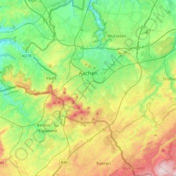
Name: Aachen topographic map, elevation, terrain.
Location: Aachen, Aachen (district), North Rhine-Westphalia, Germany (50.66214 5.97487 50.85724 6.21811)
Average elevation: 225 m
Minimum elevation: 103 m
Maximum elevation: 456 m
Make a donation
Other topographic maps
Click on a map to view its topography, its elevation and its terrain.