
Wyra River topographic map
Interactive map
Click on the map to display elevation.
About this map
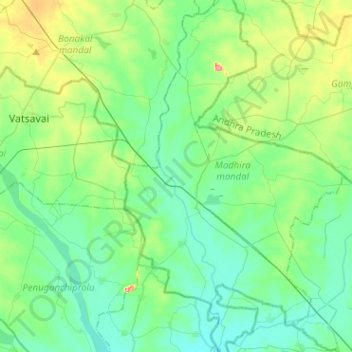
Name: Wyra River topographic map, elevation, terrain.
Location: Wyra River, Khammam, Telangana, 507203, India (16.81814 80.33510 17.06165 80.38056)
Average elevation: 68 m
Minimum elevation: 38 m
Maximum elevation: 165 m
Other topographic maps
Click on a map to view its topography, its elevation and its terrain.