
Shediac topographic map
Interactive map
Click on the map to display elevation.
About this map
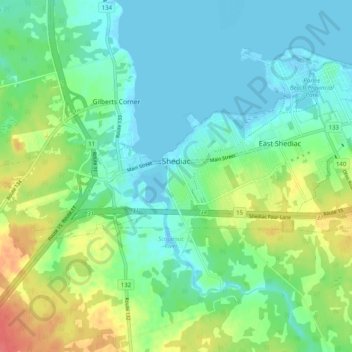
Name: Shediac topographic map, elevation, terrain.
Average elevation: 17 m
Minimum elevation: -2 m
Maximum elevation: 57 m
Other topographic maps
Click on a map to view its topography, its elevation and its terrain.
Cap-Brûlé
Canada > Nouveau-Brunswick > Shediac Parish > Beaubassin-Est
Cap-Brûlé, Beaubassin-Est, Shediac Parish, Comté de Westmorland, Nouveau-Brunswick, E4P 6P7, Canada
Average elevation: 3 m