
Thank you for supporting this site ❤️
Make a donation
Make a donation
Narippaiyur topographic map
Click on the map to display elevation.
Thank you for supporting this site ❤️
Make a donation
Make a donation
About this map
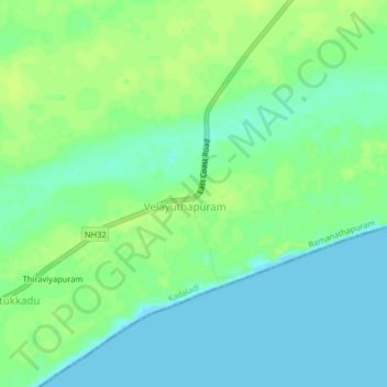
Name: Narippaiyur topographic map, elevation, terrain.
Location: Narippaiyur, Kadaladi, Ramanathapuram, Tamil Nadu, 623135, India (9.10364 78.39619 9.14364 78.43619)
Average elevation: 7 m
Minimum elevation: 0 m
Maximum elevation: 13 m
Thank you for supporting this site ❤️
Make a donation
Make a donation
Other topographic maps
Click on a map to view its topography, its elevation and its terrain.