
Thank you for supporting this site ❤️
Make a donation
Make a donation
Kasale topographic map
Click on the map to display elevation.
Thank you for supporting this site ❤️
Make a donation
Make a donation
About this map
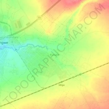
Name: Kasale topographic map, elevation, terrain.
Location: Kasale, Mbeya, Mbeya Region, Southern Highlands Zone, Tanzania (-8.97628 33.24348 -8.93628 33.28348)
Average elevation: 1,287 m
Minimum elevation: 1,248 m
Maximum elevation: 1,318 m
Thank you for supporting this site ❤️
Make a donation
Make a donation
Other topographic maps
Click on a map to view its topography, its elevation and its terrain.