
Dausa topographic map
Interactive map
Click on the map to display elevation.
About this map
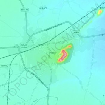
Name: Dausa topographic map, elevation, terrain.
Location: Dausa, Dausa Tehsil, Dausa District, Rajasthan, 303300, India (26.85334 76.29765 26.93334 76.37765)
Average elevation: 325 m
Minimum elevation: 302 m
Maximum elevation: 502 m
Dausa is located at 26°53′N 76°20′E / 26.88°N 76.33°E / 26.88; 76.33. It has an average elevation of 333 metres (1072 feet). It is one of the 5 Districts of Jaipur division (Alwar, Dausa, Jaipur, Jhunjhunun, Sikar.) and is surrounded with 6 districts, namely, Jaipur, Tonk, Sawai Madhopur, karauli, Bharatpur & Alwar.