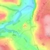
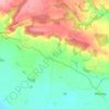
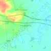
Hovingham topographic map
Click on the map to display elevation.
Hovingham
The nearest settlements are Slingsby 1.75 miles (2.82 km) to the east; Stonegrave 1.6 miles (2.6 km) to the north; Cawton 1.9 miles (3.1 km) to the north-west; Coulton 2.2 miles (3.5 km) to the west south-west and Scackleton 2.1 miles (3.4 km) to the south-west. The village lies at an elevation of 215 feet (66 m) at its highest point and is on the B1257 Malton to Stokesley road. Marrs Beck flows northwards through the village to eventually join the River Rye near Butterwick and Brawby.
About this map

Name: Hovingham topographic map, elevation, terrain.
Average elevation: 61 m
Minimum elevation: 25 m
Maximum elevation: 138 m
Other topographic maps
Click on a map to view its topography, its elevation and its terrain.
















Bolton Castle
United Kingdom > England > North Yorkshire > Redmire > Castle Bolton
Average elevation: 250 m

Thimbleby & Osmotherly Show field
United Kingdom > England > North Yorkshire > Thimbleby
Average elevation: 152 m







Killinghall
United Kingdom > England > North Yorkshire > Harrogate > Killinghall
Average elevation: 86 m



Ribblesdale
United Kingdom > England > North Yorkshire > Horton in Ribblesdale
Average elevation: 368 m

Willerby Brow Plantation
United Kingdom > England > North Yorkshire > Ryedale > Staxton > Binnington
Average elevation: 100 m