
Pilsberg topographic map
Interactive map
Click on the map to display elevation.
About this map
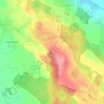
Name: Pilsberg topographic map, elevation, terrain.
Average elevation: 74 m
Minimum elevation: 17 m
Maximum elevation: 130 m
Other topographic maps
Click on a map to view its topography, its elevation and its terrain.
Darry
Deutschland > Schleswig-Holstein > Plön > Panker > Darry
Darry, Panker, Lütjenburg, Plön, Schleswig-Holstein, 24321, Deutschland
Average elevation: 63 m