
Sauldorf topographic map
Interactive map
Click on the map to display elevation.
About this map
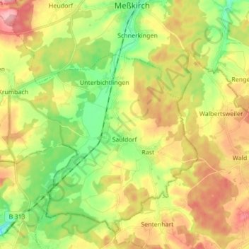
Name: Sauldorf topographic map, elevation, terrain.
Average elevation: 643 m
Minimum elevation: 585 m
Maximum elevation: 711 m
Other topographic maps
Click on a map to view its topography, its elevation and its terrain.
Levertsweiler
Deutschland > Baden-Württemberg > Landkreis Sigmaringen > Ostrach
Levertsweiler, Ostrach, Landkreis Sigmaringen, Baden-Württemberg, Deutschland
Average elevation: 623 m