
Thank you for supporting this site ❤️
Make a donation
Make a donation
Chumling topographic map
Click on the map to display elevation.
Thank you for supporting this site ❤️
Make a donation
Make a donation
About this map
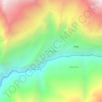
Name: Chumling topographic map, elevation, terrain.
Location: Chumling, Chum Nubri, गोरखा, Gandaki, Népal (28.45398 84.94269 28.49398 84.98269)
Average elevation: 2,799 m
Minimum elevation: 1,920 m
Maximum elevation: 4,048 m
Thank you for supporting this site ❤️
Make a donation
Make a donation
Other topographic maps
Click on a map to view its topography, its elevation and its terrain.