
Thank you for supporting this site ❤️
Make a donation
Make a donation
Yogama topographic map
Click on the map to display elevation.
Thank you for supporting this site ❤️
Make a donation
Make a donation
About this map
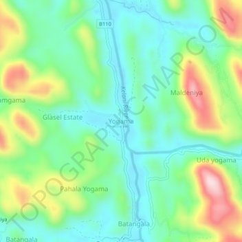
Name: Yogama topographic map, elevation, terrain.
Location: Yogama, Kegalle District, Sabaragamuwa Province, Sri Lanka (6.91019 80.25290 6.95019 80.29290)
Average elevation: 118 m
Minimum elevation: 14 m
Maximum elevation: 339 m
Thank you for supporting this site ❤️
Make a donation
Make a donation
Other topographic maps
Click on a map to view its topography, its elevation and its terrain.