Geolocate

Khardung topographic map

Interactive map

Click on the map to display elevation.

About this map

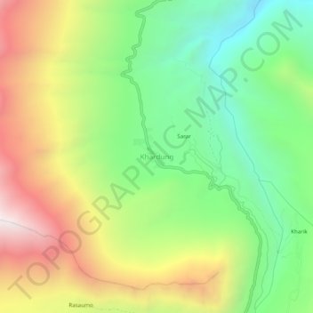
Name: Khardung topographic map, elevation, terrain.

Location: Khardung, Nubra, Leh District, Ladakh, India (34.37859 77.63685 34.41859 77.67685)

Average elevation: 4,179 m

Minimum elevation: 3,558 m

Maximum elevation: 5,036 m

Other topographic maps

Click on a map to view its topography, its elevation and its terrain.

Gapshan

India > Ladakh > Nubra

Gapshan, Nubra, Leh District, Ladakh, India

Average elevation: 4,845 m

Terche

India > Ladakh > Nubra

Terche, Nubra, Leh district, Ladakh, India

Average elevation: 3,190 m

Chang La

India > Ladakh > Nubra

Chang La, Nubra, Leh district, Ladakh, India

Average elevation: 5,464 m

Siachen Glacier

India > Ladakh > Nubra

Siachen Glacier, Nubra, Leh District, Ladakh, India

Average elevation: 5,448 m