
Jaun topographic map
Interactive map
Click on the map to display elevation.
About this map
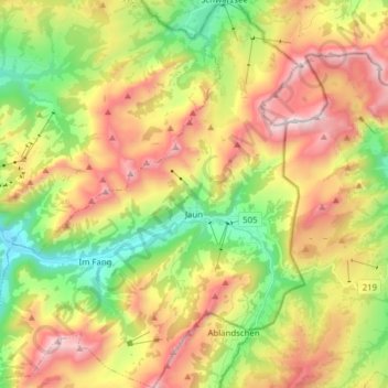
Name: Jaun topographic map, elevation, terrain.
Location: Jaun, Greyerzbezirk, Freiburg, 1656, Schweiz (46.56340 7.19399 46.67004 7.32070)
Average elevation: 1,487 m
Minimum elevation: 885 m
Maximum elevation: 2,218 m