
Pin Valley National Park topographic map
Interactive map
Click on the map to display elevation.
About this map
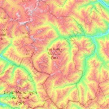
Name: Pin Valley National Park topographic map, elevation, terrain.
Average elevation: 4,903 m
Minimum elevation: 3,492 m
Maximum elevation: 6,590 m
Other topographic maps
Click on a map to view its topography, its elevation and its terrain.
Hikkim
India > Himachal Pradesh > Spiti
Hikkim, Spiti, Lahaul and Spiti District, Himachal Pradesh, India
Average elevation: 4,511 m