
Thank you for supporting this site ❤️
Make a donation
Make a donation
Bakhuisbos topographic map
Click on the map to display elevation.
Thank you for supporting this site ❤️
Make a donation
Make a donation
About this map
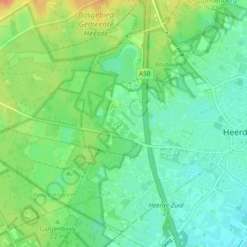
Name: Bakhuisbos topographic map, elevation, terrain.
Location: Bakhuisbos, Heerde, Gelderland, Nederland, 8181 NM, Nederland (52.37100 5.98904 52.41100 6.02904)
Average elevation: 18 m
Minimum elevation: 5 m
Maximum elevation: 41 m
Thank you for supporting this site ❤️
Make a donation
Make a donation