
Preda topographic map
Interactive map
Click on the map to display elevation.
About this map
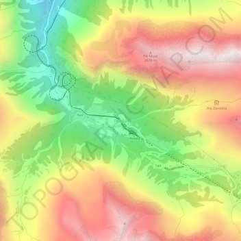
Name: Preda topographic map, elevation, terrain.
Location: Preda, Bergün Filisur, Albula, Graubünden, 7482, Schweiz (46.57043 9.75392 46.61043 9.79392)
Average elevation: 2,135 m
Minimum elevation: 1,473 m
Maximum elevation: 2,760 m
Other topographic maps
Click on a map to view its topography, its elevation and its terrain.
Bergün
Schweiz > Graubünden > Albula > Bergün Filisur
Bergün, Bergün Filisur, Albula, Graubünden, 7482, Schweiz
Average elevation: 1,725 m