
รัญญจันท์เพลส topographic map
Interactive map
Click on the map to display elevation.
About this map
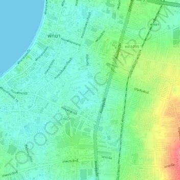
Name: รัญญจันท์เพลส topographic map, elevation, terrain.
Location: รัญญจันท์เพลส, หนองปลาไหล, Chonburi, 20150, Thaïlande (12.90467 100.87472 12.94467 100.91472)
Average elevation: 21 m
Minimum elevation: 0 m
Maximum elevation: 74 m
Other topographic maps
Click on a map to view its topography, its elevation and its terrain.