
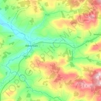
Abbeyfeale topographic map
Interactive map
Click on the map to display elevation.
About this map
Name: Abbeyfeale topographic map, elevation, terrain.
Average elevation: 150 m
Minimum elevation: 36 m
Maximum elevation: 329 m
Other topographic maps
Click on a map to view its topography, its elevation and its terrain.
Abbeyfeale
Irland > County Limerick > The Municipal District of Newcastle West > Abbeyfeale
Abbeyfeale, The Municipal District of Newcastle West, County Limerick, Munster, Irland
Average elevation: 122 m