
Thank you for supporting this site ❤️
Make a donation
Make a donation
Little Rock topographic map
Click on the map to display elevation.
Thank you for supporting this site ❤️
Make a donation
Make a donation
About this map
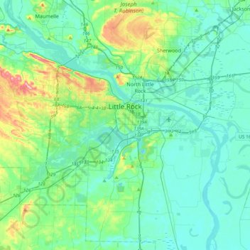
Name: Little Rock topographic map, elevation, terrain.
Location: Little Rock, Pulaski County, Arkansas, United States (34.62567 -92.52159 34.82182 -92.15066)
Average elevation: 96 m
Minimum elevation: 63 m
Maximum elevation: 244 m
Thank you for supporting this site ❤️
Make a donation
Make a donation
Other topographic maps
Click on a map to view its topography, its elevation and its terrain.