
Hurst topographic map
Interactive map
Click on the map to display elevation.
About this map
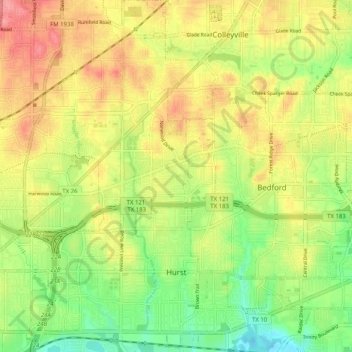
Name: Hurst topographic map, elevation, terrain.
Location: Hurst, Tarrant County, Texas, Vereinigte Staaten von Amerika (32.80417 -97.21236 32.88924 -97.13726)
Average elevation: 182 m
Minimum elevation: 141 m
Maximum elevation: 221 m