
Bougaa topographic map
Interactive map
Click on the map to display elevation.
About this map
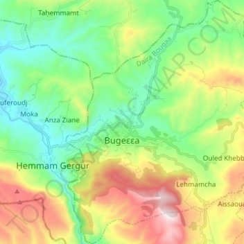
Name: Bougaa topographic map, elevation, terrain.
Location: Bougaa, Daïra Bougaa, Sétif, 19003, Algérie (36.29028 5.06127 36.38883 5.16745)
Average elevation: 948 m
Minimum elevation: 602 m
Maximum elevation: 1,609 m