
Satbunga topographic map
Click on the map to display elevation.
About this map
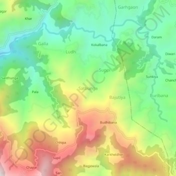
Name: Satbunga topographic map, elevation, terrain.
Location: Satbunga, Kosya Kutauli, Nainital, Uttarakhand, India (29.42868 79.59088 29.46868 79.63088)
Average elevation: 1,933 m
Minimum elevation: 1,557 m
Maximum elevation: 2,487 m