
Horná Lehota topographic map
Interactive map
Click on the map to display elevation.
About this map
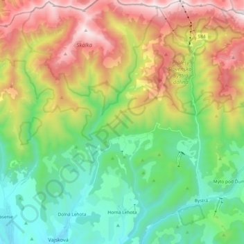
Name: Horná Lehota topographic map, elevation, terrain.
Average elevation: 1,032 m
Minimum elevation: 469 m
Maximum elevation: 2,014 m
Other topographic maps
Click on a map to view its topography, its elevation and its terrain.
Sedmák
Slovakia > Region of Banská Bystrica > District of Brezno > Čierny Balog
Sedmák, Čierny Balog, District of Brezno, Region of Banská Bystrica, Central Slovakia, Slovakia
Average elevation: 924 m