
Desmond topographic map
Interactive map
Click on the map to display elevation.
About this map
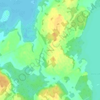
Name: Desmond topographic map, elevation, terrain.
Average elevation: 148 m
Minimum elevation: 135 m
Maximum elevation: 168 m
Other topographic maps
Click on a map to view its topography, its elevation and its terrain.
Yarker
Canada > Ontario > Lennox and Addington County > Stone Mills
Yarker, Stone Mills, Lennox and Addington County, Eastern Ontario, Ontario, K0K 3N0, Canada
Average elevation: 152 m