
District de Lệ Thủy topographic map
Interactive map
Click on the map to display elevation.
About this map
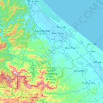
Name: District de Lệ Thủy topographic map, elevation, terrain.
Location: District de Lệ Thủy, Province de Quảng Bình, 47306, Viêt Nam (16.92137 106.40207 17.32981 106.99444)
Average elevation: 171 m
Minimum elevation: -2 m
Maximum elevation: 1,231 m