
Thank you for supporting this site ❤️
Make a donation
Make a donation
Val topographic map
Click on the map to display elevation.
Thank you for supporting this site ❤️
Make a donation
Make a donation
About this map
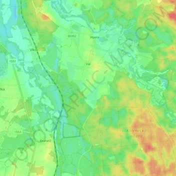
Name: Val topographic map, elevation, terrain.
Location: Val, okres Tábor, Jihočeský kraj, Southwest, Czechia (49.10953 14.72219 49.16429 14.82240)
Average elevation: 424 m
Minimum elevation: 403 m
Maximum elevation: 457 m
Thank you for supporting this site ❤️
Make a donation
Make a donation