
Thalheim an der Thur topographic map
Interactive map
Click on the map to display elevation.
About this map
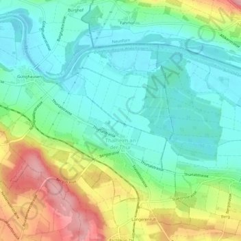
Name: Thalheim an der Thur topographic map, elevation, terrain.
Location: Thalheim an der Thur, Bezirk Andelfingen, Zürich, 8478, Schweiz (47.56702 8.71778 47.59690 8.76878)
Average elevation: 412 m
Minimum elevation: 366 m
Maximum elevation: 507 m
Other topographic maps
Click on a map to view its topography, its elevation and its terrain.
Wiler
Schweiz > Zürich > Bezirk Andelfingen > Buch am Irchel
Wiler, Buch am Irchel, Bezirk Andelfingen, Zürich, 8414, Schweiz
Average elevation: 502 m
Stammheim
Schweiz > Zürich > Bezirk Andelfingen
Stammheim, Bezirk Andelfingen, Zürich, Schweiz
Average elevation: 473 m