Thank you for supporting this site ❤️
Make a donation
Make a donation
Hunton topographic map
Click on the map to display elevation.
Thank you for supporting this site ❤️
Make a donation
Make a donation
About this map
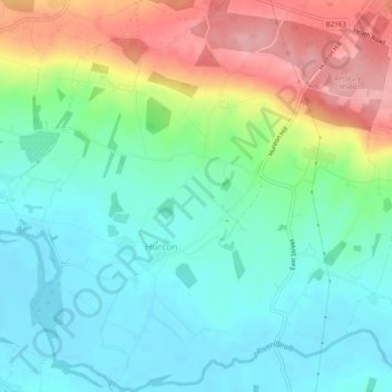
Name: Hunton topographic map, elevation, terrain.
Location: Hunton, Maidstone, Kent, England, United Kingdom (51.20753 0.44049 51.23810 0.48844)
Average elevation: 52 m
Minimum elevation: 10 m
Maximum elevation: 134 m
Thank you for supporting this site ❤️
Make a donation
Make a donation
Other topographic maps
Click on a map to view its topography, its elevation and its terrain.
Thank you for supporting this site ❤️
Make a donation
Make a donation
Thank you for supporting this site ❤️
Make a donation
Make a donation
Thank you for supporting this site ❤️
Make a donation
Make a donation
Thank you for supporting this site ❤️
Make a donation
Make a donation
The Hernitage and High Noon Farm
United Kingdom > England > Kent > Maidstone > Detling
Average elevation: 145 m
Thank you for supporting this site ❤️
Make a donation
Make a donation
