
LaPorte County topographic map
Interactive map
Click on the map to display elevation.
About this map
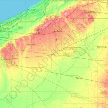
Name: LaPorte County topographic map, elevation, terrain.
Location: LaPorte County, Indiana, États-Unis d'Amérique (41.23680 -86.93416 41.76104 -86.48617)
Average elevation: 219 m
Minimum elevation: 175 m
Maximum elevation: 290 m