
Glavanovtsi topographic map
Interactive map
Click on the map to display elevation.
About this map
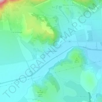
Name: Glavanovtsi topographic map, elevation, terrain.
Location: Glavanovtsi, Tran, Pernik, Bulgaria (42.79672 22.50477 42.83672 22.54477)
Average elevation: 806 m
Minimum elevation: 747 m
Maximum elevation: 1,089 m