
Thank you for supporting this site ❤️
Make a donation
Make a donation
El Reno topographic map
Click on the map to display elevation.
Thank you for supporting this site ❤️
Make a donation
Make a donation
About this map
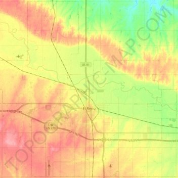
Name: El Reno topographic map, elevation, terrain.
Location: El Reno, Canadian County, Oklahoma, United States (35.46457 -98.06545 35.63852 -97.84877)
Average elevation: 410 m
Minimum elevation: 360 m
Maximum elevation: 453 m
Thank you for supporting this site ❤️
Make a donation
Make a donation