
Thank you for supporting this site ❤️
Make a donation
Make a donation
Necedah topographic map
Click on the map to display elevation.
Thank you for supporting this site ❤️
Make a donation
Make a donation
About this map
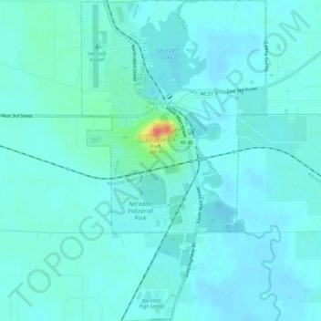
Name: Necedah topographic map, elevation, terrain.
Location: Necedah, Juneau County, Wisconsin, United States (43.99868 -90.08759 44.03906 -90.05506)
Average elevation: 277 m
Minimum elevation: 270 m
Maximum elevation: 321 m
Thank you for supporting this site ❤️
Make a donation
Make a donation
Other topographic maps
Click on a map to view its topography, its elevation and its terrain.