
Thank you for supporting this site ❤️
Make a donation
Make a donation
Meander River topographic map
Click on the map to display elevation.
Thank you for supporting this site ❤️
Make a donation
Make a donation
About this map
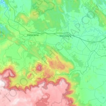
Name: Meander River topographic map, elevation, terrain.
Location: Meander River, Tasmania, 7304, Australia (-41.73354 146.49004 -41.46004 147.05327)
Average elevation: 417 m
Minimum elevation: 50 m
Maximum elevation: 1,423 m
Thank you for supporting this site ❤️
Make a donation
Make a donation
Other topographic maps
Click on a map to view its topography, its elevation and its terrain.