
Thank you for supporting this site ❤️
Make a donation
Make a donation
La Prairie topographic map
Click on the map to display elevation.
Thank you for supporting this site ❤️
Make a donation
Make a donation
About this map
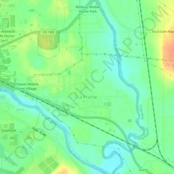
Name: La Prairie topographic map, elevation, terrain.
Location: La Prairie, Itasca County, Minnesota, United States (47.21527 -93.51222 47.24452 -93.47496)
Average elevation: 393 m
Minimum elevation: 377 m
Maximum elevation: 418 m
Thank you for supporting this site ❤️
Make a donation
Make a donation
Other topographic maps
Click on a map to view its topography, its elevation and its terrain.