
Thank you for supporting this site ❤️
Make a donation
Make a donation
Rayadurgam topographic map
Click on the map to display elevation.
Thank you for supporting this site ❤️
Make a donation
Make a donation
About this map
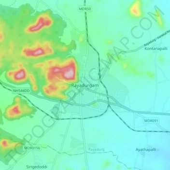
Name: Rayadurgam topographic map, elevation, terrain.
Location: Rayadurgam, Rayadurg, Anantapur, Andhra Pradesh, 515865, India (14.65994 76.81004 14.73994 76.89004)
Average elevation: 576 m
Minimum elevation: 515 m
Maximum elevation: 811 m
Thank you for supporting this site ❤️
Make a donation
Make a donation