
Dodge County topographic map
Interactive map
Click on the map to display elevation.
About this map
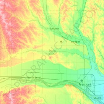
Name: Dodge County topographic map, elevation, terrain.
Location: Dodge County, Nebraska, Vereinigte Staaten von Amerika (41.39314 -96.90604 41.74276 -96.32855)
Average elevation: 404 m
Minimum elevation: 351 m
Maximum elevation: 501 m