
Thank you for supporting this site ❤️
Make a donation
Make a donation
Ashanti Region topographic map
Click on the map to display elevation.
Thank you for supporting this site ❤️
Make a donation
Make a donation
About this map
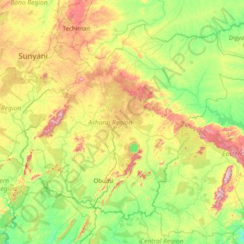
Name: Ashanti Region topographic map, elevation, terrain.
Location: Ashanti Region, Ghana (5.85504 -2.45159 7.62270 -0.23761)
Average elevation: 208 m
Minimum elevation: 43 m
Maximum elevation: 819 m
Thank you for supporting this site ❤️
Make a donation
Make a donation
Other topographic maps
Click on a map to view its topography, its elevation and its terrain.
Thank you for supporting this site ❤️
Make a donation
Make a donation
Thank you for supporting this site ❤️
Make a donation
Make a donation