
Kampala topographic map
Interactive map
Click on the map to display elevation.
About this map
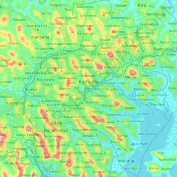
Name: Kampala topographic map, elevation, terrain.
Location: Kampala, Central Region, Ouganda (0.21436 32.50988 0.40577 32.66874)
Average elevation: 1,179 m
Minimum elevation: 1,128 m
Maximum elevation: 1,315 m
Other topographic maps
Click on a map to view its topography, its elevation and its terrain.