
Mnetěš topographic map
Interactive map
Click on the map to display elevation.
About this map
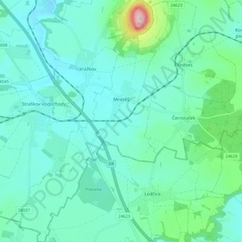
Name: Mnetěš topographic map, elevation, terrain.
Location: Mnetěš, okres Litoměřice, Ústecký kraj, Northwest, Czechia (50.32836 14.24027 50.39132 14.29665)
Average elevation: 237 m
Minimum elevation: 193 m
Maximum elevation: 452 m