
Thank you for supporting this site ❤️
Make a donation
Make a donation
Rock Port topographic map
Click on the map to display elevation.
Thank you for supporting this site ❤️
Make a donation
Make a donation
About this map
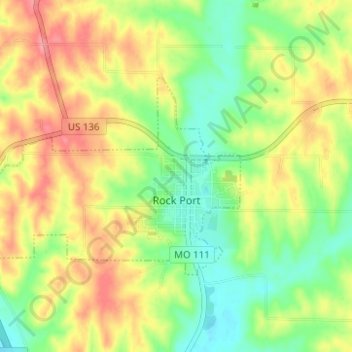
Name: Rock Port topographic map, elevation, terrain.
Location: Rock Port, Atchison County, Missouri, United States (40.40112 -95.56762 40.42759 -95.50563)
Average elevation: 318 m
Minimum elevation: 277 m
Maximum elevation: 364 m
Thank you for supporting this site ❤️
Make a donation
Make a donation
Other topographic maps
Click on a map to view its topography, its elevation and its terrain.