
Hooge Maey topographic map
Interactive map
Click on the map to display elevation.
About this map
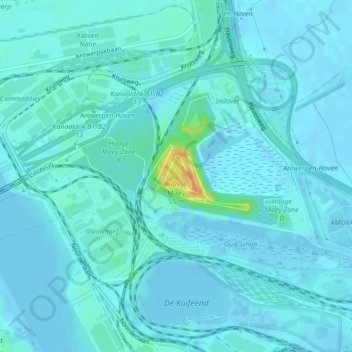
Name: Hooge Maey topographic map, elevation, terrain.
Location: Hooge Maey, Antwerp, Flanders, 2940, Belgium (51.30903 4.34468 51.30913 4.34478)
Average elevation: 5 m
Minimum elevation: -7 m
Maximum elevation: 41 m
Other topographic maps
Click on a map to view its topography, its elevation and its terrain.