
Thank you for supporting this site ❤️
Make a donation
Make a donation
Edapally topographic map
Click on the map to display elevation.
Thank you for supporting this site ❤️
Make a donation
Make a donation
About this map
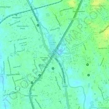
Name: Edapally topographic map, elevation, terrain.
Location: Edapally, Kanayannur, Ernakulam district, Kerala, India (10.01887 76.30304 10.03057 76.31402)
Average elevation: 9 m
Minimum elevation: 1 m
Maximum elevation: 18 m
Thank you for supporting this site ❤️
Make a donation
Make a donation