
Thank you for supporting this site ❤️
Make a donation
Make a donation
Fairy Castle topographic map
Click on the map to display elevation.
Thank you for supporting this site ❤️
Make a donation
Make a donation
About this map
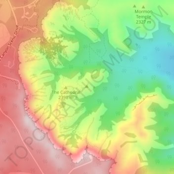
Name: Fairy Castle topographic map, elevation, terrain.
Location: Fairy Castle, Garfield County, Utah, United States (37.61496 -112.15751 37.61506 -112.15741)
Average elevation: 2,355 m
Minimum elevation: 2,150 m
Maximum elevation: 2,551 m
Thank you for supporting this site ❤️
Make a donation
Make a donation
Other topographic maps
Click on a map to view its topography, its elevation and its terrain.