
Thank you for supporting this site ❤️
Make a donation
Make a donation
Teng topographic map
Click on the map to display elevation.
Thank you for supporting this site ❤️
Make a donation
Make a donation
About this map
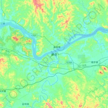
Name: Teng topographic map, elevation, terrain.
Location: Teng, Teng County, Wuzhou City, Guangxi, 543000, China (23.21805 110.75031 23.53805 111.07031)
Average elevation: 92 m
Minimum elevation: 6 m
Maximum elevation: 439 m
Thank you for supporting this site ❤️
Make a donation
Make a donation